Road accidents remain a serious safety concern in Kenya, particularly along busy highways used by petroleum tankers, buses, trucks, motorcycles and private vehicles. The Energy and Petroleum Regulatory Authority’s Nairobi and Central Region Driver’s Handbook identifies several high-risk zones and road hazards that drivers should approach carefully.
The handbook primarily guides petroleum tanker drivers, but its findings are relevant to every road user. It covers accident causes, dangerous road conditions, defensive driving, vehicle safety and high-risk locations across Nairobi, Kiambu, Machakos, Kajiado and Central Kenya
How Can Accidents Be Reduced?
EPRA recommends maintaining road markings, repairing guardrails, improving pedestrian crossings and keeping road shoulders in good condition. It also calls for designated petroleum-tanker parking areas instead of roadside parking.
Transport companies should employ qualified, well-rested drivers and maintain vehicles properly. Individual motorists can reduce risk by observing speed limits, avoiding dangerous overtaking, leaving enough stopping distance and adjusting their driving during rain, fog or darkness.
Accident Black Spots and High-Risk Roads in Kenya
The handbook uses terms such as reported accident hot spots, identified hot spots and high-risk zones. Therefore, not every location mentioned should automatically be interpreted as an officially gazetted accident black spot. However, each area contains conditions that could increase the possibility or severity of an accident.
Waiyaki Way
Waiyaki Way is identified during EPRA’s road survey because of shrubs between the carriageways. Overgrown vegetation can reduce visibility, conceal pedestrians or motorcycles and make it harder for drivers to notice hazards developing on the opposite side of the road.
Waiyaki Way forms part of the A104 Northern Corridor, connecting Nairobi through Chiromo Road towards Kikuyu, Limuru, Naivasha and destinations farther west. Its traffic mix includes private cars, matatus, motorcycles, buses and heavy commercial vehicles.
Limuru and Limuru Flyover
EPRA identifies several risks around Limuru, including:
- Heavy traffic flow
- Livestock entering the road
- Worn-out road shoulders
- People sitting on flyover guardrails
- A history of fatal accidents around the flyover
The Limuru Viewpoint section also presents risks associated with steep terrain, poor lane discipline and missing guardrails. Drivers of heavy vehicles should avoid freewheeling downhill because it reduces control and can contribute to brake failure.
Muguga and Nairobi–Naivasha Road
The handbook reports a tanker accident at Muguga along the Nairobi–Naivasha Road. The recorded risk factors included reckless driving, poor visibility, darkness, hilly terrain and drizzling weather.
This demonstrates how several seemingly manageable risks can combine. A wet road reduces tyre grip, while darkness and hills limit the distance a driver can see ahead.
Kinale Forest Junction and Soko Mjinga
Kinale Forest Junction and Soko Mjinga present hazards such as roadside hawkers, narrow shoulders and a junction located near a bus stop. Pedestrians, stopping matatus and traders operating near the carriageway can produce sudden movements that drivers may not anticipate.
Kikuyu and Kibera Area
EPRA notes faded lane markings and an undesignated pedestrian crossing around the Kikuyu/Kibera area. Poor road markings make lane positioning difficult, especially at night or during rain. Undesignated crossings also expose pedestrians to fast-moving vehicles.
Githurai and Thika Superhighway
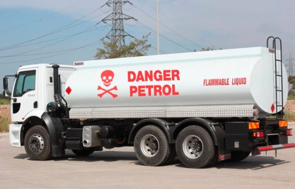
The handbook records tanker incidents around Githurai. One involved a cabin fire attributed to an electrical wiring fault. Another occurred near the Githurai footbridge when a vehicle reportedly cut in after overtaking, causing the tanker driver to lose control and hit roadside bollards before overturning.
These incidents underline the importance of vehicle inspection, safe following distance and defensive driving.
Kamandura–Mai Mahiu Road
The Kamandura–Mai Mahiu section is associated with tanker rollovers. One incident at Monkey Corner was attributed to brake failure on a downhill gradient, while another rollover occurred during wet conditions and was associated with speeding.
Steep descents require lower speeds and proper gear selection. Heavy-vehicle drivers should inspect braking systems before beginning a journey and avoid waiting until a descent to control speed.
Mombasa Road and Athi River
EPRA documents tanker rollovers around Athi River, Lukenya and Mto Mawe. Factors mentioned include driver fatigue, speeding, loss of control and another vehicle cutting in while overtaking.
Mombasa Road carries large volumes of commercial traffic, making proper lane discipline, safe overtaking and adequate following distance particularly important.
Leading Causes of Accidents on Kenyan Roads
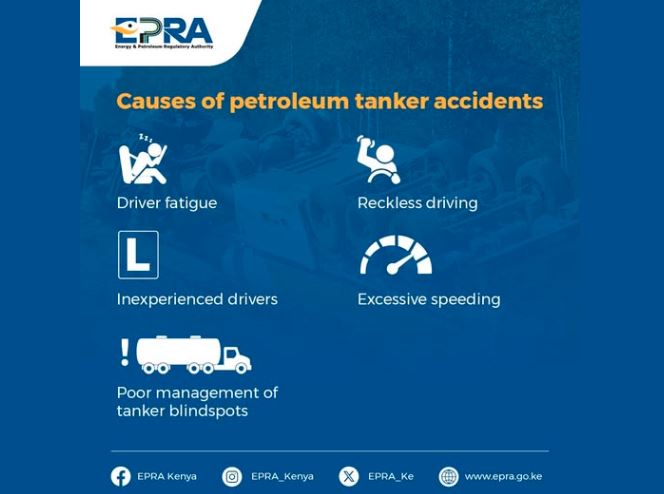
The handbook highlights several recurring causes and contributing factors:
- Speeding and reckless overtaking
- Driver fatigue
- Brake or electrical failure
- Poor visibility and wet weather
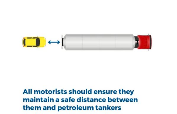
- Failure to maintain a safe distance
- Pedestrians entering the road unexpectedly
- Faded markings and worn-out shoulders
- Livestock and roadside trading
- Improper roadside parking
- Distracted driving and poor lane discipline
Drivers are advised to plan their journeys, inspect their vehicles, reduce speed according to conditions and remain alert around settlements, bus stops, junctions and pedestrian crossings.